Iztaccihuatl - The sleeping lady (Mexiko Volcano 5230m) | 5202m
| Elevation gain |
| Elevation loss |
| Distance |
| Duration |
| Highest altitude |
| Rating |
Route Information
In Aztec mythology, Iztaccíhuatl was a princess who fell in love with one of her father's warriors, Popocatépetl. The emperor sent Popocatépetl to war in Oaxaca, promising him Iztaccíhuatl as his wife when he returned (which Iztaccíhuatl's father presumed he would not). Iztaccíhuatl was falsely told that Popocatépetl had died in battle, and believing the news, she died of grief. When Popocatépetl returned to find his love dead, he took her body to a spot outside Tenochtitlan and kneeled by her grave. The gods covered them with snow and changed them into mountains. Iztaccíhuatl's mountain is called "White Woman" (from Nahuatl iztāc "white" and cihuātl "woman") because it resembles a woman lying on her back, and is often covered with snow — the peak is sometimes nicknamed La Mujer Dormida, "The Sleeping Woman". Popocatépetl became an active volcano, raining fire on Earth in blind rage at the loss of his beloved (source Wikipedia)
Iztacchihuatl is the 3rd highest mountain in Mexico and the 2nd highest climbable mountain. (the 2nd highest overall Popocatépetl is an active volcano and access is forbidden - for good reasons!)
The trail starts at the car parking near La Joya at 3980m. La Joya is reachable from Puebla or Mexico city. The road up is constantly bumpy, cars move at a speed of max 10kmh and it takes about 3 hours which take their toll to the passangers.
Most of the hikers put up a tent at the car parking in the evening and start the hike at 01:00am. The obvious advantage is that no tents need to be carried (since the tents are set at the parking). An alternative is to carry the tents near the Rifugio of the 100, 3-4h from La Joya and camp around there.
Back to the main scenario, starting at 01:00am with little to no acclimatization, the path is constantly ascending, T scale is T2 and then T3 and reaches the first peak at around 5000am after 5-6hours.After it, and this is not shown in the map, is the constant up and down, remaining at around 5000m attitude since three 5000m peaks need to be reached before the main peak. The T Scale remains T3, max T4 with no very exposed places, with the exception of the glacier. The glacier is between the second to last and the last (main) peak and is steep at its entrance and exit. This is the only, if any, technically challenging place. But it is not more challenging than typical Hochtouren in the Alpes. I would rate it as T4 but please take it with a grain of salt, I am not liable for this! There, crampons and ice axes are indispensable. I personally did not see any crevasses on the main path (i saw many further down), i did see though a few teams securing themselves with rope.
A typical duration to go up is 8-9 hours.The way down 5-6 hours.
Needless to say that every step in this attitude is tiring. Without sleep the night before and without acclimatization the hike poses significant challenges!
According to my guide, the tour is possible around the year , with some months having more snow than others.
Weekends are pretty packed, as Mexicans choose to do the tour on weekends. Weekdays are the total opposite. I did the hike with "summitted.mx" (instagram account) , they were friendly, spoke English and overall organized everything exceptionally well. They also rent whatever you may need.
You may see some photos of the tour at the events page, but i also recommond you dont see much in advance (except if for safety reasons) and let your self get surprised and immersed in the landscape and the views.
| Technical Difficulty | Very Easy | |||||||||||
|---|---|---|---|---|---|---|---|---|---|---|---|---|
| Gear | ||||||||||||
| Popularity | 1 | |||||||||||
Route statistics
| Highest point | 5202m | |||||||||||
|---|---|---|---|---|---|---|---|---|---|---|---|---|
| Total gain | 1462m | |||||||||||
| Total loss | 1462m | |||||||||||
| Duration | 07h00m | |||||||||||
| Distance | 12.2Km | |||||||||||
| Rating | 1467 | |||||||||||
Best Season
Forecast
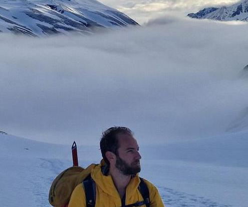
Author