Lindenkopf Damkar loop | 2292m
| Elevation gain |
| Elevation loss |
| Distance |
| Duration |
| Highest altitude |
| Rating |
Route Information
Automatic peak(s) detection (experimental feature)
The route passes by the following peaks:
- Lindenkopf (1795 m)
- Gamseck (1717 m)
-------
User provided description:
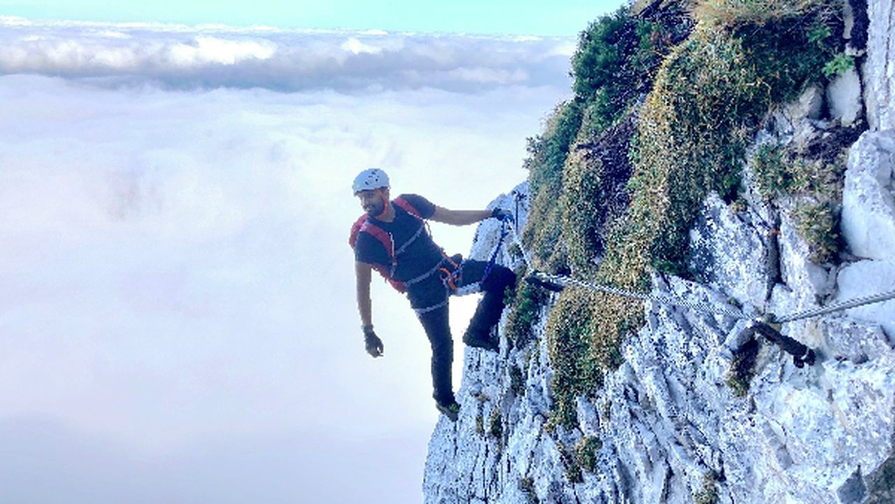
The route targets Lindekopf and Damkar in Mittenwald. The aim is to reach Lindenkopf, a rather short hike with T3-level difficulty. The route then takes us up to Karwendelbahn Bergstation, the most demanding part of the route with a difficulty level of T4. This is not a typical klettersteig route. However, use of helmets and gloves are highly recommended in the T4 section. The elevation gain is about 1800m and it is not beginner friendly.
Automatic direction calculation (experimental feature, please provide feedback)
By car: Navigate using Google maps
By public transport:
Train station near start point: Mittenwald (0.1 Km from start point)
Bus stop near start point: Mittenwald Bahnhof/Postamt (62 m from start point)
Ref : 2
------
Automatic hut detection (experimental feature, please provide feedback)
Mittenwalder Hütte (1518 m):
Website: Homepage
Url: Homepage
Phone: +49-172-8558877
Location: Google maps
Dammkarhütte (1650 m):
Website: Homepage
Phone: +4988233826
Location: Google maps
------
| Technical Difficulty | Medium Difficult | |||||||||||
|---|---|---|---|---|---|---|---|---|---|---|---|---|
| Gear | Hiking Boots , Hiking Poles , Helmet , Gloves | |||||||||||
| Popularity | 0 | |||||||||||
Route statistics
| Highest point | 2292m | |||||||||||
|---|---|---|---|---|---|---|---|---|---|---|---|---|
| Total gain | 1779m | |||||||||||
| Total loss | 1779m | |||||||||||
| Duration | 08h05m | |||||||||||
| Distance | 16.1Km | |||||||||||
| Rating | 1548 | |||||||||||
Best Season
Forecast
Author