Bayerwald-Roßstein-Buchstein-Leonhardstein-Kreuth | 1701m
| Elevation gain |
| Elevation loss |
| Distance |
| Duration |
| Highest altitude |
| Rating |
Route Information
Automatic peak(s) detection (experimental feature)
The route passes by the following peaks:
- Roßstein (1698 m)
- Buchstein (1701 m)
- Leonhardstein (1452 m)
-------
User-provided description:
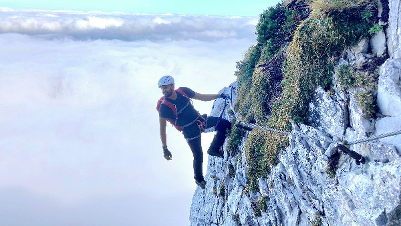
This route takes you from Bayerwald to Kreuth via the 3 beautiful peaks listed above. The path to Roßstein is secured with a cable and has via Ferrata A. The climb to Buchstein from Tegernseer Hütte is not for beginners. It is T5-T6 level on the SAC scale with I+ UIAA climbing section. A Helmet and gloves are highly recommended for this climb. Finally, the route takes you to Leonhardstein with simple scrambling to get to the top.
Automatic direction calculation (experimental feature, please provide feedback)
By car: Navigate using Google maps
By public transport:
Train station near start point: Lenggries (10.6 Km from start point)
Bus stop near start point: Tegernseer Hütte Bushst., Kreuth (19 m from start point)
Bus stop near start point: Bayerwald, Kreuth (661 m from start point)
Train station near end point: Tegernsee (7.8 Km from end point)
Bus stop near end point: Riedlerbrücke, Kreuth (36 m from end point)
------
Automatic hut detection (experimental feature, please provide feedback)
Tegernseer Hütte (1650 m):
Location: Google maps
Buchsteinhütte
Location: Google maps
------
| Technical Difficulty | Difficult | |||||||||||
|---|---|---|---|---|---|---|---|---|---|---|---|---|
| Gear | Hiking Boots , Hiking Poles , Klettersteig Set , Helmet , Gloves | |||||||||||
| Popularity | 1 | |||||||||||
Route statistics
| Highest point | 1701m | |||||||||||
|---|---|---|---|---|---|---|---|---|---|---|---|---|
| Total gain | 1242m | |||||||||||
| Total loss | 1329m | |||||||||||
| Duration | 05h49m | |||||||||||
| Distance | 13.9Km | |||||||||||
| Rating | 1156 | |||||||||||
Best Season
Forecast
Author