Ridge Hike - Neuhaus to Spitzingsee with Spitzingsee loop | 1685m
| Elevation gain |
| Elevation loss |
| Distance |
| Duration |
| Highest altitude |
| Rating |
Route Information
Acknowledgement: This is a modified version of the route created by Prem (Route link), modified into a loop around Spitzingsee back to Neuhaus.
Automatic peak(s) detection (experimental feature)
Automatic peak(s) detection (experimental feature)
The route passes by the following peaks:
- Anklspitz (1112 m)
- Dürnbachwand (1260 m)
- Schlierseespitz (1279 m)
- Brecherspitz Vorgipfel (1643 m)
- Brecherspitz (1685 m)
-------
User-provided description:
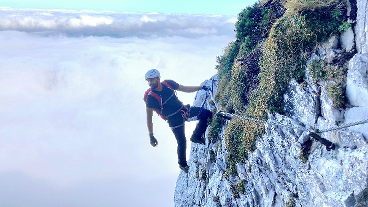
- This ridge hike is not for beginners and should only be attempted by experienced hikers.
- The technical grade is marked as SAC T6 on Hiking Buddies, however, the actual difficulty is between T4 and T5. Only 2 scrambling sections are present with decent exposure, with a climbing grade UIAA I.
- The descent from Brecherspitz to Spitzingsee is marked "Absteig Lebensgefahr", and one needs to exercise caution while descending here.
- There are huts and restaurants near Spitzingsee for food and refreshments. (They also accept car payments)
Automatic direction calculation (experimental feature, please provide feedback)
By car: Navigate using Google maps
By public transport:
Train station near start point: Fischhausen-Neuhaus (0.1 Km from start point)
Bus stop near start point: Neuhaus Bahnhof (27 m from start point)
Ref : 1
Bus stop near start point: Fischhausen (677 m from start point)
Ref : 1
------
| Technical Difficulty | Very Difficult | |||||||||||
|---|---|---|---|---|---|---|---|---|---|---|---|---|
| Gear | Hiking Boots , Hiking Poles , Helmet , Gloves | |||||||||||
| Popularity | 1 | |||||||||||
Route statistics
| Highest point | 1685m | |||||||||||
|---|---|---|---|---|---|---|---|---|---|---|---|---|
| Total gain | 1183m | |||||||||||
| Total loss | 1183m | |||||||||||
| Duration | 07h17m | |||||||||||
| Distance | 16.8Km | |||||||||||
| Rating | 1444 | |||||||||||
Best Season
Forecast
Author