El Teide (3,718 m) - Highest Mountain of Spain [2 days] | 3558m
| Elevation gain |
| Elevation loss |
| Distance |
| Duration |
| Highest altitude |
| Rating |
Route Information
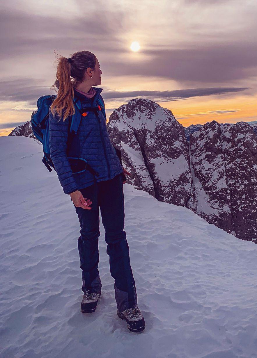
! To go up the last path to the summit/ the krater of El Teide you need a special permit you can acquire from the national parc! Alternatively you can stay the night at Refugio Altavista which then allows you to ascend the last part to the summit before 9am. This option also allows you to see the sunrise from the summit. (Headlamp required).
This route guides you across the beautiful landscape of Teide National Park. You need to bring food and water for two days. There are only very few options to throw away litter.
Starting at Portillo Alto (start around noon or in the afternoon - depending on how fast you are) passing Montaña de los Tomillos, then heading towards Montanña Rajada and ascending onto Moñtana Blanca. From there you continue to hike up to Refugio de Altavista, where you will spend the night. They don’t have drinking water from the tab only water in the vending machines.
The next morning you have to leave before 7am (even earlier to see the sunrise). You will ascend the last steep and exposed part to Pico del Teide. It is usually very windy. You need warm clothes, gloves and a hat.
Descending the same route to Telesforo Bravo from where you will turn towards Pico Viéjo. Passing it and following the paths through beautiful valleys down to a nice rock formation. You can choose to end the hike here or ascend on the other side with a great view on Teide and then descend to Vilaflor, one of the highest lying villages of Spain.
Refugio Altavista
Sunscreen, sunglasses, warm clothes, water and food for two days, hat, gloves
Most paths are T2/T3. Mostly very rocky terrain. Some parts are T4.
Extreme Temperature differences: Its very warm in lower terrain and when the sun is shining, but gets very cold and super windy towards the peak and when the sun is gone.
| Technical Difficulty | Very Easy | |||||||||||
|---|---|---|---|---|---|---|---|---|---|---|---|---|
| Gear | Hiking Boots , Hiking Poles , Gloves | |||||||||||
| Popularity | 0 | |||||||||||
Route statistics
| Highest point | 3558m | |||||||||||
|---|---|---|---|---|---|---|---|---|---|---|---|---|
| Total gain | 1913m | |||||||||||
| Total loss | 2617m | |||||||||||
| Duration | 16h39m | |||||||||||
| Distance | 35.2Km | |||||||||||
| Rating | 2138 | |||||||||||
Best Season
Forecast
Author